September 8-9- Family Weekend

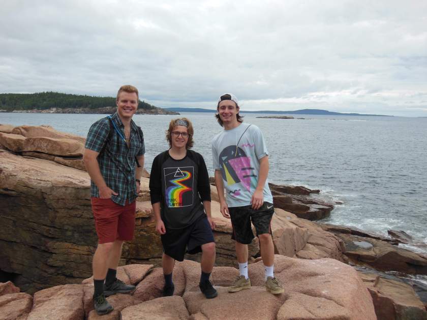
Recently, the Ordway clan (my parents and brothers) came for a weekend visit. My parents braved the elements at the Mount Desert Island Campground (in a tent) and my brothers stayed with us as they are too faint of heart for tent sleeping. Here are some highlights from the weekend:

We cooked over a fire at the campground. Dinner came out well despite a teetering grate which threatened to dump our food into the fire on several occasions. But compared to successfully cooking a batch of Jiffy Pop, dinner was unexciting. I think our only successful Jiffy Pop attempts in history have occurred over a gas stove (which, of course, is cheating). When cooking over a fire, we were left with unpopped, charred kernels and a few sad, smoky popped kernels that nobody wanted to eat. Because of our previously dismal Jiffy Pop attempts, we bought two for insurance when we were grocery shopping in Bar Harbor earlier that evening. As suspected, there was an overwhelming smoky taste and lots of unpopped kernels on the first attempt. I had little hope for batch number two, but was proved wrong by Dad’s artful mastery of the proper shaking technique combined with some tinfoil sculpting by Harrison. Here are the tips for successful poppage:

  1. Make a tinfoil “extender” for the handle. This makes it possible to hold the Jiffy Pop close to the fire without burning off any fingers.
  2. Shake the Jiffy Pop from start to finish, even though the package suggests shaking only after the popping starts.

After five minutes of shaking, we were rewarded with a tinfoil balloon filled with tender, buttery corn.

I wonder if the CEO of Jiffy Pop feels guilty for continuing to make money on the lost hopes and dreams of campers, who buy the product on a whim each camping trip with wistful dreams of hot popcorn on a summer night. On the other hand, perhaps this is where their genius comes in. After all, humans do love to gamble. With Jiffy Pop, as in casino games, you’ve got a slim chance of a reward, and the company gets their profits regardless of whether you win or lose. Furthermore, one win urges us to play more, now that we feel we have mastered the game. Will our tinfoil extender prove successful in the future? We’ll have to buy more Jiffy Pop to find out, and so the cycle continues.

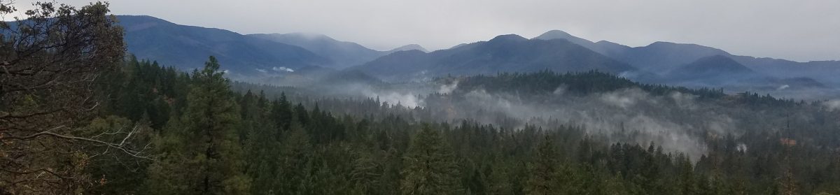
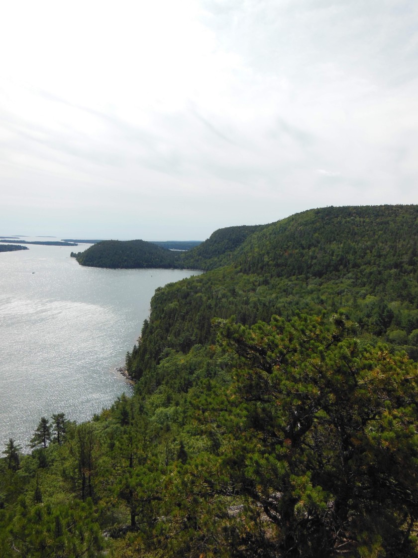
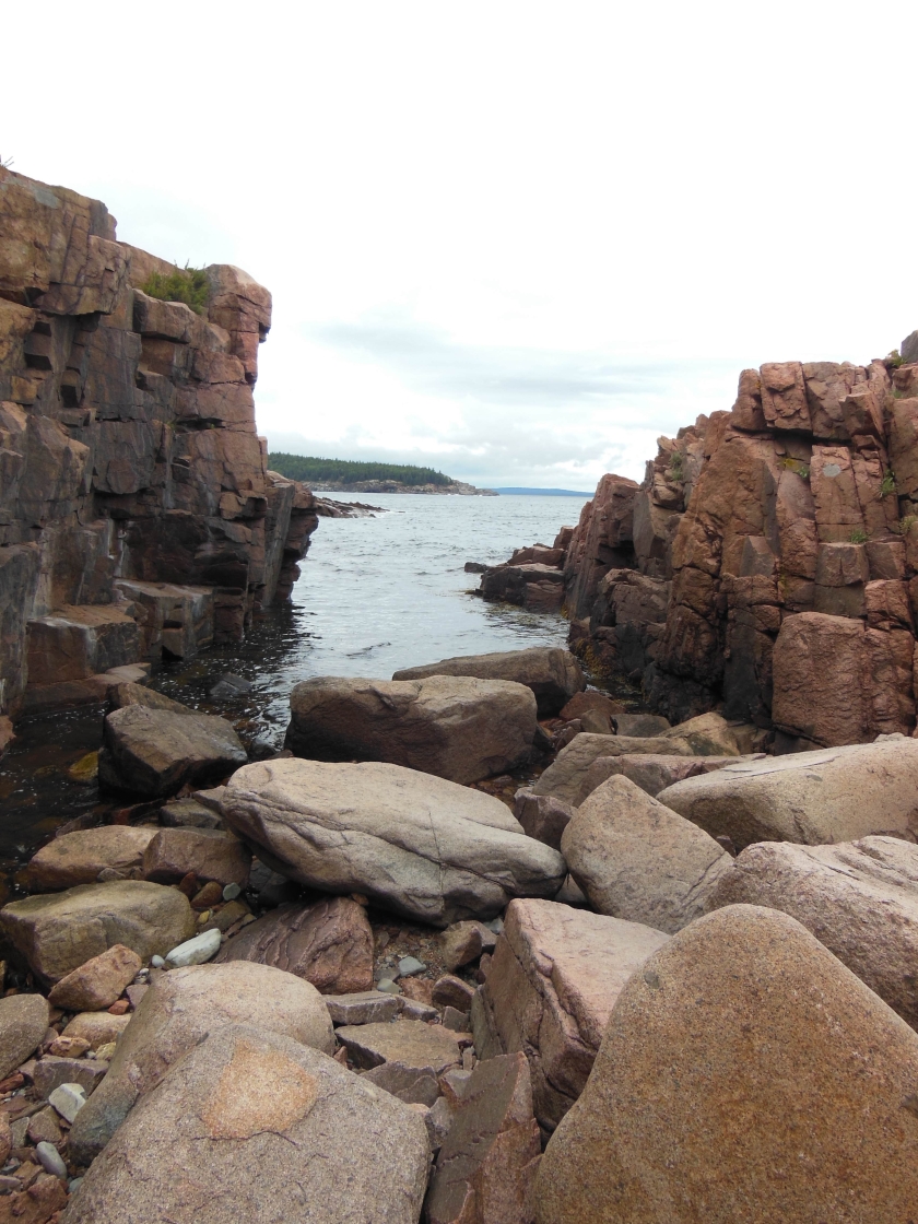
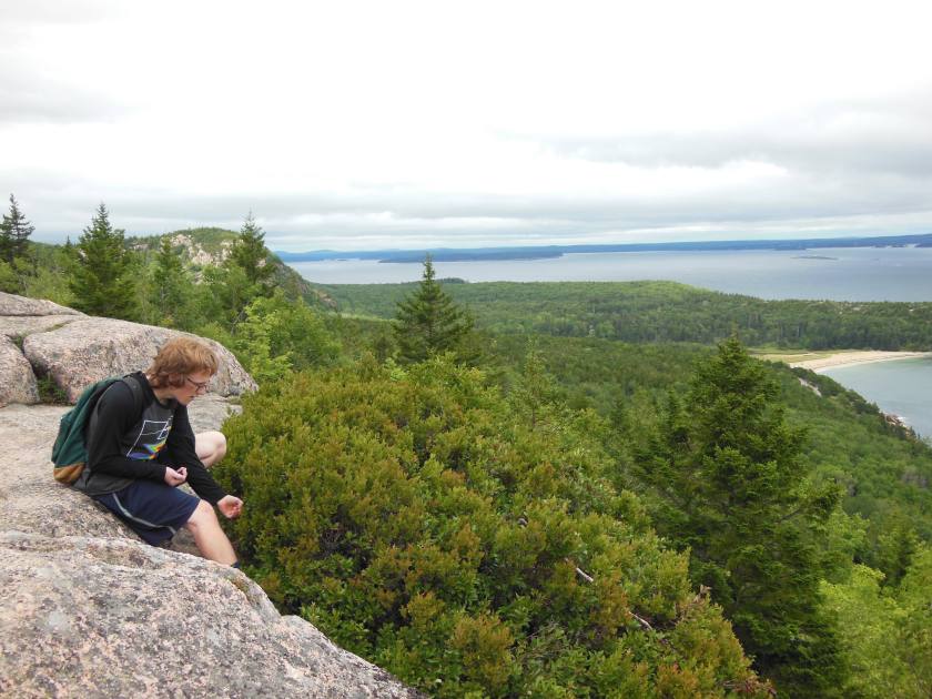
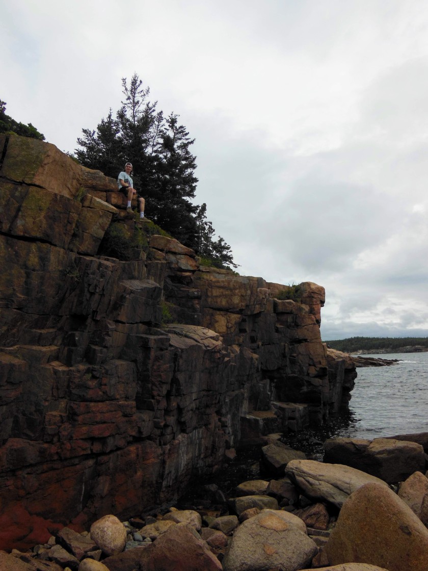
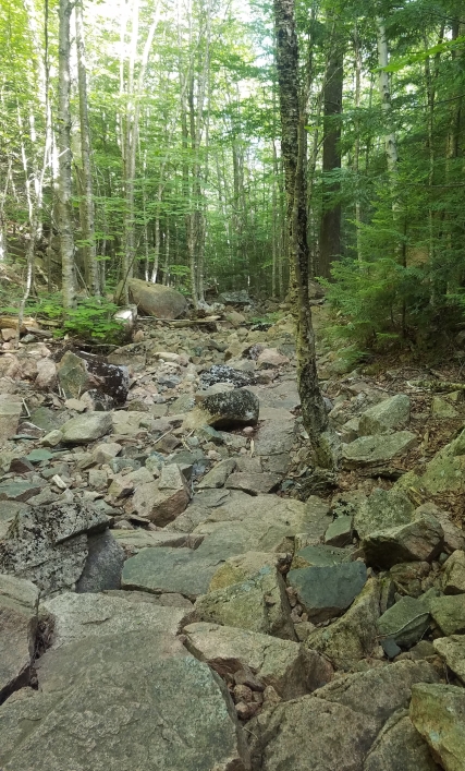
The next day, we explored the “quiet side” of the island (the west side). We decided to hike Acadia Mountain, which overlooks the Somes Sound. The trail head is a five-minute drive from the Mount Desert Island campground (our starting point for the day). From the parking lot, we could see the shore of Echo Lake just a short walk down through the woods, and across the road is the trail head. There’s about a mile to walk before the summit, and some of the mile is fairly steep. We were almost the only people on the summit, which was a welcome change after the crowds in most other hiking spots. After that, we headed down the other side of the mountain where there were even better views along the way. We connected with the Man O’ War Brook Fire Road at the bottom to get back to the parking lot.

dscn0905
Acadia Mountain views
dscn0897
Harrison, Patrick, Mom and Keith doing some summit exploring

The boys got changed for swimming and we headed down to the Echo Lake Ledges, a two-minute walk from the parking area. Upon reaching the lake, we found a large, sloped rock with an area perfect for cannonballing (definitely not deep enough to dive). To get out of the water after jumping, there are some rock “steps” and an iron rung situated just so. Mom and I didn’t think we wanted to swim so we did not change, but regretted that after watching Harrison and Keith jump in. September is the time of year when I start to feel summer slipping away and (happy as I am to greet fall) there’s that panicky “gotta squeeze summer to the last drop” feeling. By the time we returned, Patrick and Dad were in the water as well. It was cool but not cold, and felt clean. Across the lake, we were treated to views of giant cliffs and a few trees which were just starting to turn. The beauty of this spot is we timed it to have it almost to ourselves. We shared the large rock with a woman who had stopped for a picnic lunch and some reading, and that’s it. I love a good “secret” spot, though I’m sure we were just lucky. It’s probably packed on a hot summer day.

We headed to Southwest Harbor for lunch. This town was a teeny-tiny, calm version of Bar Harbor. There’s a little one-road downtown area and all the shops and restaurants are packed into just a couple blocks. We found a place called Little Notch Bakery and stopped in for sandwiches after eyeing their homemade bread in the windows. As we suspected, the sandwiches were delicious and the bread was the highlight. I had a roasted eggplant and goat cheese on a baguette. The vegetables were flavorful and the bread had a lovely crunchy crust. Disclaimer- I don’t recommend the cookies. We tried three kinds and none of them were worthy of writing about. Southwest Harbor was a nice change of pace from the chaos of Bar Harbor, especially on a weekend.

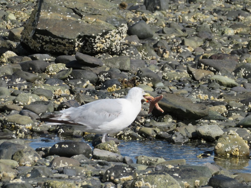
The last highlight from the weekend was the Bar Island Trail. This trail, accessible only 1 ½ hours before and after low tide, is a sandbar that goes from Bar Harbor to an island a half-mile off shore. Upon reaching the island, the trail continues another half-mile to the summit. The summit is little more than a small hill, and would be a fun hike for little kids. We saw people walking it in flip flops and sun dresses. The sand bar has lots of small tide pools with snails stuck all over the rocks. We were lucky enough to see a gull who had caught a star fish.

20180907020537_IMG_0219_1

20180907015731_IMG_0215_1
Walking towards the island on the sand bar

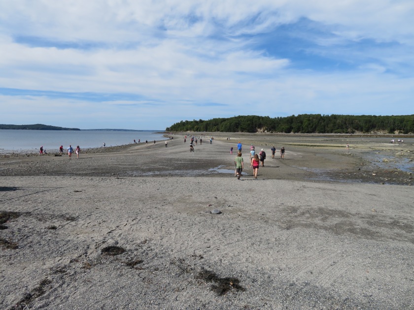
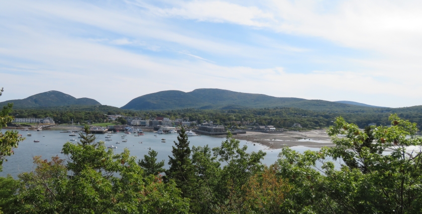
On the island, a sign with a phone number of a water taxi company greets you just in case you get stranded by the tide. It’s a $50 ride if you get stuck! When we reached the summit, the view was blocked by some trees so we continued on just a little further to a small look out point which offered great views of Bar Harbor and the mountains.

20180907022300_IMG_0227
The view of Bar Harbor from the island


September 1st- Jordan Pond area

The days are getting shorter, the nights are cooler. I have already made two batches of pumpkin bread, and the apple orchards are open with early Macintosh apples ready to pick. The days are still warm, but the first leaves are starting to change already in Maine. Fall is almost upon us and I am ready. I have lived in New England all my life and have been awed by the trees every single year I can remember. It is one of the privileges of living in a place with four seasons. I can smell the seasons changing. There comes a morning in late summer where the air is cool in a way it hasn’t been cool in months. A breeze comes which is different from those sticky summer breezes, and it smells like pine needles and drying leaves and cool dirt. This to me is the sign that we are almost at the close of another summer. The fall is a time of both joy and a sense of loss, because it passes too quickly every year, leaving behind skeleton trees and brown landscapes of dry grass not yet covered with snow.

This weekend we planned out a loop that included the Bubble Mountains, Connor’s Nubble, and Jordan Pond in Acadia National Park. This loop provided us views of Jordan Pond and Eagle Lake from above, as well as enjoying them from the shore. I swear one of these weekends I’ll do something besides hike, but…not this weekend. This area of the park was beautiful and though the route we chose was long (about 9 miles) there was a good mix of walking uphill, downhill, and over flat areas. I highly recommend taking the Bubbles trail from South Bubble to North Bubble, then continuing on to Conner’s Nubble. Yes, it tickles me that these places rhyme and are adjacent. The Bubbles trail is fairly steep, but also short (just about a mile to summit South Bubble). South Bubble summit has some views of Eagle Lake, but to be honest the best part about that summit is the Bubble Rock, which is a boulder that looks like it’s about to fall off the mountain.

Okay, it looks more impressive in real life, but you get the picture. From South Bubble, continue on to North Bubble. From here, you can see views of Jordan Pond.

DSCN0846
View of Jordan Pond from North Bubble

My favorite part of this hike came after North Bubble. Here, we were hiking along a path bordering some cliffs with great open views of Eagle Lake. Our destination was Conner’s Nubble. Most of this 0.8 mile stretch is level ground, then there’s a descent which takes hikers to a crossing with a carriage road. Across the carriage road, there’s a very short but steep ascent to the top. We stopped here for a snack because the views were spectacular.

DSCN0858
Eagle Lake from Conner’s Nubble

We descended and connected with Eagle Lake trail, which was practically deserted for much of our walk, despite the fact that it was a Saturday, mid-morning, and Labor Day weekend. We walked through the thick pine forest along the edge of Eagle Lake, stopping frequently to look into the clear water and try to spot fish.

We continued on Eagle Lake path to Jordan Pond Carry, which led us to, duh, Jordan Pond. We took the loop around the pond, and here we could enjoy the view of what we had hiked earlier in the day. Half of the Jordan Pond path is gravel and is very easy, flat walking. Once we reached the south side of the pond we were rewarded of views of the Bubble mountains. Jordan Pond is picturesque, and it’s easy to see why this path was well-trafficked.

DSCN0871
The Bubbles peeking out
DSCN0883
View of the Bubble Mountains from Jordan Pond


Image result for north going zax south going zax
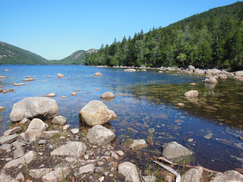
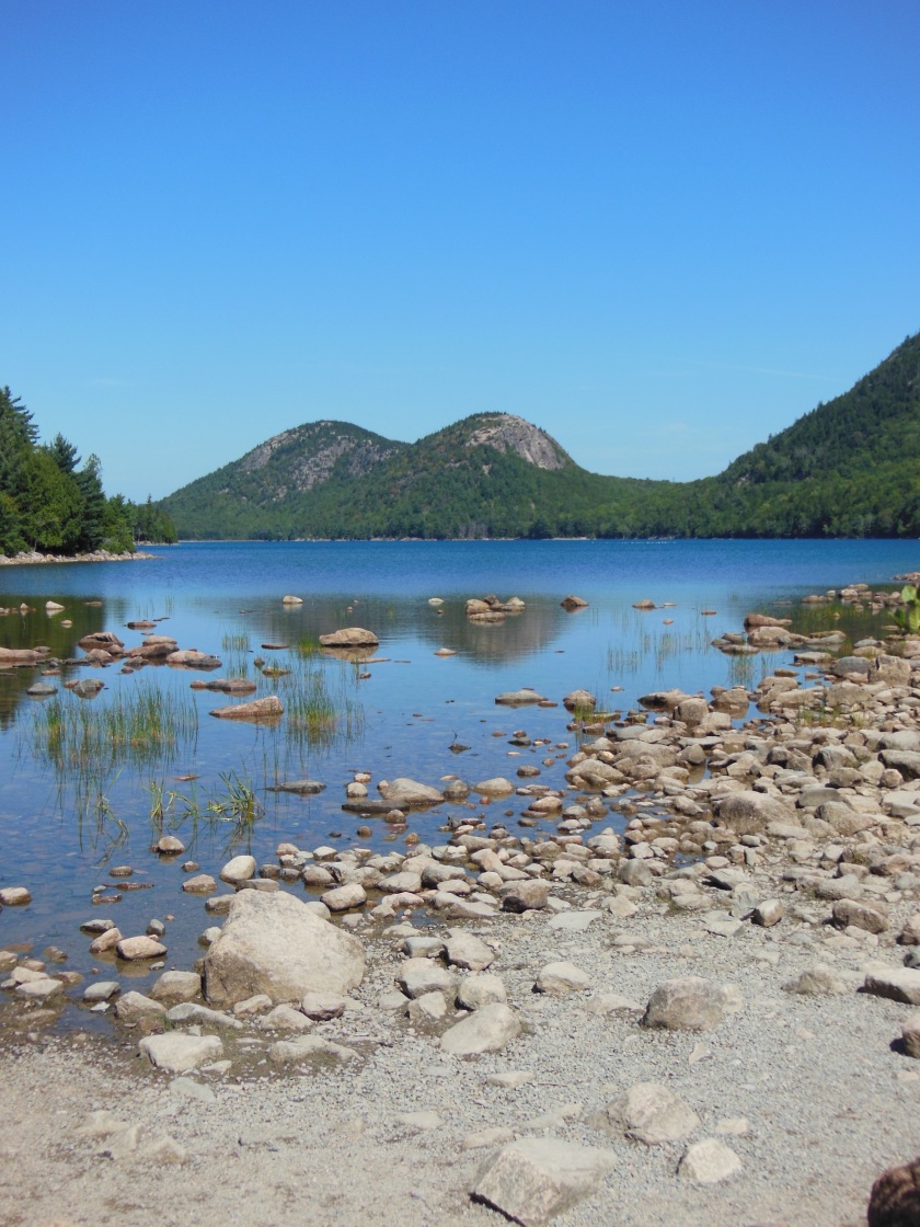
After coming around the south end of the pond, we stepped onto a boardwalk made of two slim, side-by-side boards. The signs instruct not to step off the boardwalk for plant restoration, there would have been a few north-going Zax vs. south-going Zax moments had we not stepped onto the ground beside the walk (sorry restoration zone, I tried to step on rocks, not plants). The boardwalk felt long, but it was probably no longer than 3/4 of a mile. After finally traversing the boardwalk section, we came upon a rocky section which required a little stealth. Finally, we emerged onto a regular old dirt path which brought us back to the Jordan Pond Carry, where we headed for the Bubbles parking lot. Phew!


20180901_121628
A bird at Jordan Pond


August 18-19- The Brothers Visit (Part 2)

This is the story of hiking the Precipice trail with Patrick and Harrison and Keith (see Part 1 if you haven’t already). Upon entering the trail head, we met a park ranger standing in a power stance in the middle of the trail, feet wide and hands clasped behind his back. His surfer hair did not match the warning look on his face. He explained the best way to come down (it’s not recommended to descend Precipice) and asked if we had enough food and water. Confirming that we had plenty, we set off. Then we passed a warning sign urging anyone with a fear of heights to turn back. They take this path seriously. Oh, if you’re wondering who the mastermind behind this trail was, the man’s name was Rudolph Brunnow, and he was a professor at Princeton University in his time. He vacationed in a giant brick “cottage” which now houses interns and students at the Jackson Laboratory, according to the Mount Desert Island Preservation Society. Brunnow is also responsible for Beehive Trail–he clearly was a fan of those iron rungs! Once we passed the point of no return, we moved slowly up the trail behind lots of foot traffic. Often I would be waiting behind a group of hikers and look up to see Keith and Patrick 15′ above me. They had gone up by climbing the bare rock instead of using the hand holds or ladders, which meant they were able to pass everyone on the trail. “It’s easier,” Keith said. Yup, just like doing laundry before washing machines was easier, I’m sure…

I don’t have any pictures of the ascent because I was focused on not falling, but we all made it! Here’s us at the top:

dscn0825
Champlain Mountain Summit

Patrick didn’t want to be in the photo so instead he offered to take it. Thanks, Patrick! We followed the Orange and Black path down, as instructed by the park ranger who greeted us in the beginning of the hike. Then guess what they all wanted to do? Beehive trail. Yup. So I sucked it up and ate a Clif bar and climbed that sucker again. It was a democracy and I was outvoted. Why is democracy so great in government and so terrible in personal life? I have to admit it was easier than I expected because being on the edge of a cliff was not so new anymore. This was a welcome change.

After completing Beehive we were all ready for some food so we stopped and got some sandwiches in Ellsworth. We also had some big plans to buy a couple of inflatable tubes and go down to Branch Lake (the area we scoped out the night before). After hitting both Marden’s and Wal-Mart and finding only toddler-sized tubes, arm floaties, and giant unicorn floats, we gave up. August is not the time to be buying tubes I guess. The next best option was to go home, hang out and make some pizza for dinner, which is exactly what we did.


dscn08102
Patrick, Harrison and Keith


August 18-19- The Brothers Visit (Part 1)

This past weekend, my brothers Harrison and Keith came for a visit and some exploring. There’s nothing like being outnumbered by boys to get me quickly out of my comfort zone! You may have heard of the famous Precipice Trail (Acadia NP), which is an exposed trail on the side of a cliff that ascends about 1,000′ in a mile. Hikers must use iron rungs and ladders to help ascend this difficult path to the summit of Champlain Mountain. Of course, this was the trail they all wanted to climb so we made plans to do it.

My brothers arrived midday on Saturday and it had been a wet and rainy morning in Maine, followed by a cloudy and humid afternoon. Because of the moisture, I insisted we didn’t hike Precipice that day (the peanut gallery argued, of course, but I won in the end). Instead we hiked Gorham Mountain, which Patrick and I knew to be a fairly easy hike with some great views. We ascended via The Bowl trail, which leads by a small pond on the side of Gorham Mountain.

After taking a minute to snack and enjoy the scenery we continued on to Gorham Mountain summit where Harrison almost decided he was going to camp out until the end of blueberry season. We practically had to drag him out of the patch of bushes he found. After his tongue had been dyed a very Violet Beauregarde blue, we descended down the Cadillac Cliffs trail. Of course, they needed to climb and see how far up the cliffs they could get.

We took Ocean Path back to the car, exploring along the way.

dscn0802
Ocean Path exploring
dscn07591
Blueberry picking on Gorham Mountain
dscn08072
Climbing more high things

We stopped for Jamaican food at Taste Jamaica in Ellsworth on the way home. It’s a small, bright red joint decorated with lights and a Jamaican flag. Inside is a counter and the kitchen (take out, or eat on one of their picnic tables outside). Jerk chicken, jerk pork, rice and beans, fried plantains, and some mixed veggies later we headed for home (or so I thought). Then I got roped into one more adventure as the sun was setting. We passed by Branch Lake State Park and Patrick unexpectedly pulled in. The sign advertised a mile walk to the lake front. The sun was setting and the place was completely deserted. We started walking on an old logging road while looking out for the turn into the woods which would take us to the lake shore. By the time we reached the water, we didn’t have much time to look around as it was getting dark quickly, but the clouds were beautiful and the water was clear. Definitely a spot I would like to go back to in the daylight.

Stick around for Part 2, where I’ll write about Precipice Trail!

August 11th- Cadillac Mountain

Another day in Acadia! We chose to hike Cadillac Mountain, the tallest mountain in the park at 1,529′. It’s not a monster in size but since it’s so close to the ocean the views are fantastic. We decided to take Gorge Path to the top. There were only a few parking spaces here, and the more popular North Ridge Trail leading to the summit of Cadillac was already packed with cars. We headed onto Gorge Path and began the trek. This trail starts out with a gradual slope through a pine forest. Patrick and I enjoyed the cool, dry air of the morning. About a mile or so into the hike, the trail starts to ascend over boulders and stairs. The steep grade continues for the rest of the hike. Luckily, there’s only a little over a mile of the steeper terrain.

20180811_094548
Gorge Trail

At a fork in the trail, hikers can either head to Dorr Mountain, or hang a right and continue up to Cadillac (the trails are very well marked). Shortly after this fork are the first views of the ocean and surrounding islands. We stopped to enjoy the view and to pick some wild blueberries we found along the trail. 20180811_10131020180811_101845
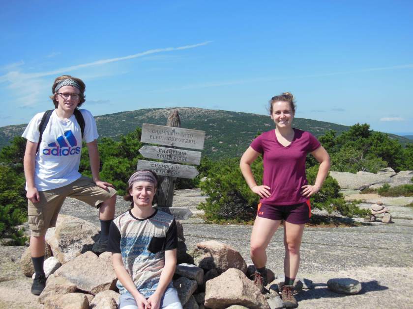
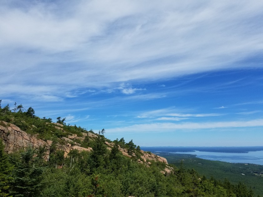
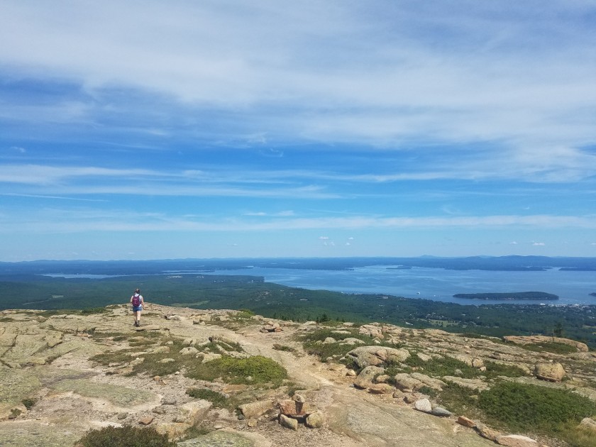
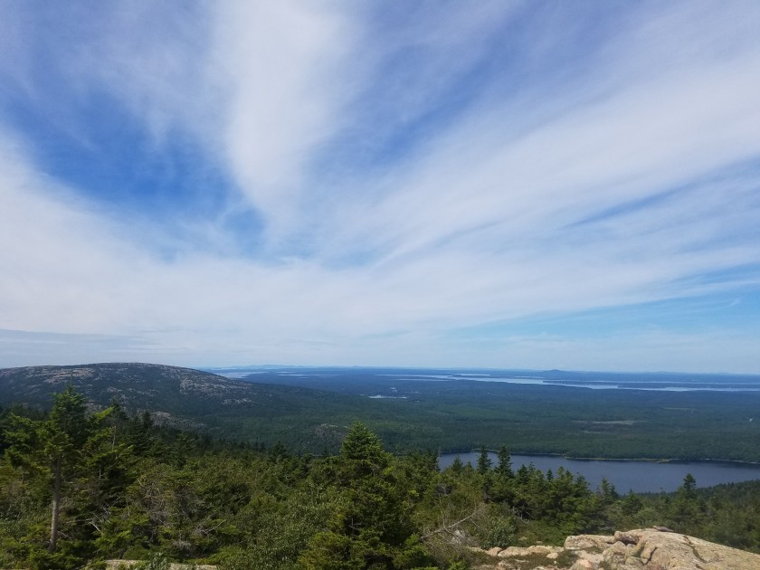
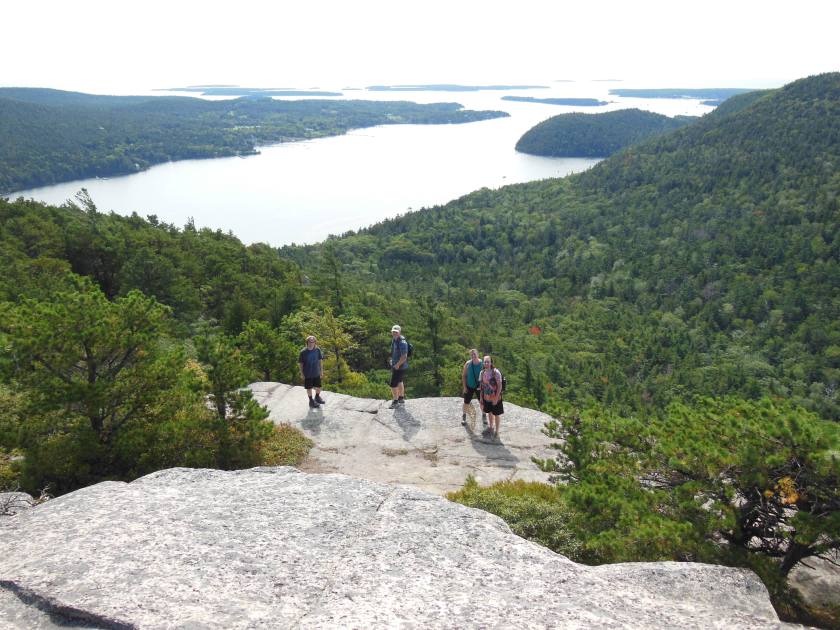
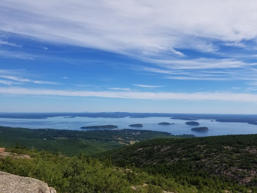
At the summit, we walked around enjoying the 360º views. Because it is possible to drive to the summit, there was quite a crowd of people up there. After finding a spot to rest and enjoy for a bit, we headed down North Ridge Trail. This trail turned out to have beautiful views of Eagle Lake and the ocean all the way down. North Ridge is far more exposed than Gorge Path with little to no tree cover for the entire 2.2 miles.

20180811_111258
Heading down North Ridge Trail
20180811_111417
North Ridge Trail

Here are a few more shots from the hike:

On the way down, Patrick and I talked about the auto road and whether or not we should build them. It’s easy to make the argument that because an auto road decreases the wildlife habitat of the mountain while also increasing the amount of human traffic on the summit, we shouldn’t build them. But is it fair to restrict ALL mountain summits to only the people who are able to walk all the way up?

I fall a little bit onto each side. I did get annoyed when I arrived at the summit of Cadillac, hot and sweaty after a two mile climb, to a crowd of people looking cool and comfortable in their flip flops and sun dresses. However, I’m guilty of disliking any horde of people, so perhaps my vote shouldn’t count here. On the other hand, I don’t think it’s fair for those with a physical disability to never enjoy a mountain view. Do you fall into one category, or are you bit of both? Leave me a comment if you’d like to chime in!


August 4th- Acadia National Park

August is living up to it’s reputation of unrelenting humidity, which is why I am not sharing any pictures of Patrick and I on this post! If you can imagine a short person and a tall person, both looking like they just took a dip with all their clothes on, then you can imagine what we looked like as we hiked Beehive trail in Acadia National Park this past weekend.

We started the day at the Hull’s Cove Visitor Center to buy our annual parks pass and a trail map. Then we took the Park Loop Road to get to the Sand Beach parking lot, where we began the hike. This parking lot has restrooms and changing rooms for the beach, as well as a water fountain. We arrived about 9:00 am on a Saturday, and the parking lot was still about half empty, however when we were leaving about 2:00 pm we had cars doing the “creep” behind us so they could take our parking space. As long as you don’t mind walking to get where you’d like to go, there are plenty of other parking areas across the street and down the road a bit. We parked and then headed on to our trailhead.

The Beehive trail begins on the East side of the park, breaking off of the Ocean Path and heading into the forest for a short while before dumping hikers out onto cliff ledges for the rest of the climb. Many areas have helpful iron holds which are necessary through some of the steeper and more exposed areas to prevent falling. If you have a fear of heights, I don’t recommend this trail–there are some areas where you must walk along a three-foot wide ledge with nothing stopping you from falling off the edge. I crept along the inside of the ledge holding on to the cliff.

This was me:

Shrek, I’m looking down!

Thankfully, instead of boiling lava I had views like this:

dscn06851
Fog rolling in over the bluffs

We made it to the summit of Beehive and headed on to Gorham Mountain before taking the Cadillac Cliffs trail back to the Ocean Path.

After descending, we took the Ocean Path back to Sand Beach area, passing cliffs and ocean views along the way. This gravel path was pretty crowded but most people stick right to the path. Walking out onto the rocks adjacent to the path means you’ll encounter far fewer people.dscn0708

Once we reached Sand Beach again, we took off our hiking boots to wade into the 55° water for a few minutes before getting in the car to complete the Park Loop road and exit the park.

On the way home, we stopped in Ellsworth for a quick lunch at Flexit Cafe. This quirky spot has sandwiches, salads, fresh juice and pastries. I ordered BLT on homemade toasted white bread. Patrick went for the Cubano sandwich. We also tried a juice for the hell of it–an orange/carrot concoction. Yep, tasted like carrots. I don’t think we’re “juicers” but the sandwiches were delicious.

Until next time–

Amelia